
Land boundaries from OpenPlanetData #
- Open Regions, then Get Region.
- Choose OpenPlanetData from Region source. Sources are ordered OSM, OpenPlanetData, iNaturalist.
- Enter a Polish or English country name, such as Bulgaria, or its ISO code BG. Find regions by the provider's name or ISO code, such as BG-02. Click Search.
- Click Preview. The map fits the downloaded boundary.
- Inspect the coastline and islands, then click Load boundary.
- Enter a Region name and click Save and activate. Previewing or loading alone does not save a Region.
OpenPlanetData or OSM? #
The screenshots below show two Greece boundaries found in ENTOMONE. They do not represent two versions of the same boundary definition:
- OpenPlanetData prepares a land outline. The boundary follows the coastline
- OSM returns an administrative relation. For a country, it may include
of the mainland and each island without including the sea between them. This is usually more suitable for filtering terrestrial biological records, preparing distribution maps and compiling species lists for the country's land area.
territorial waters. In the Greece example, the outline connects the mainland, islands and large sea areas between them. This is useful when the administrative extent of the country is required rather than only its land surface.
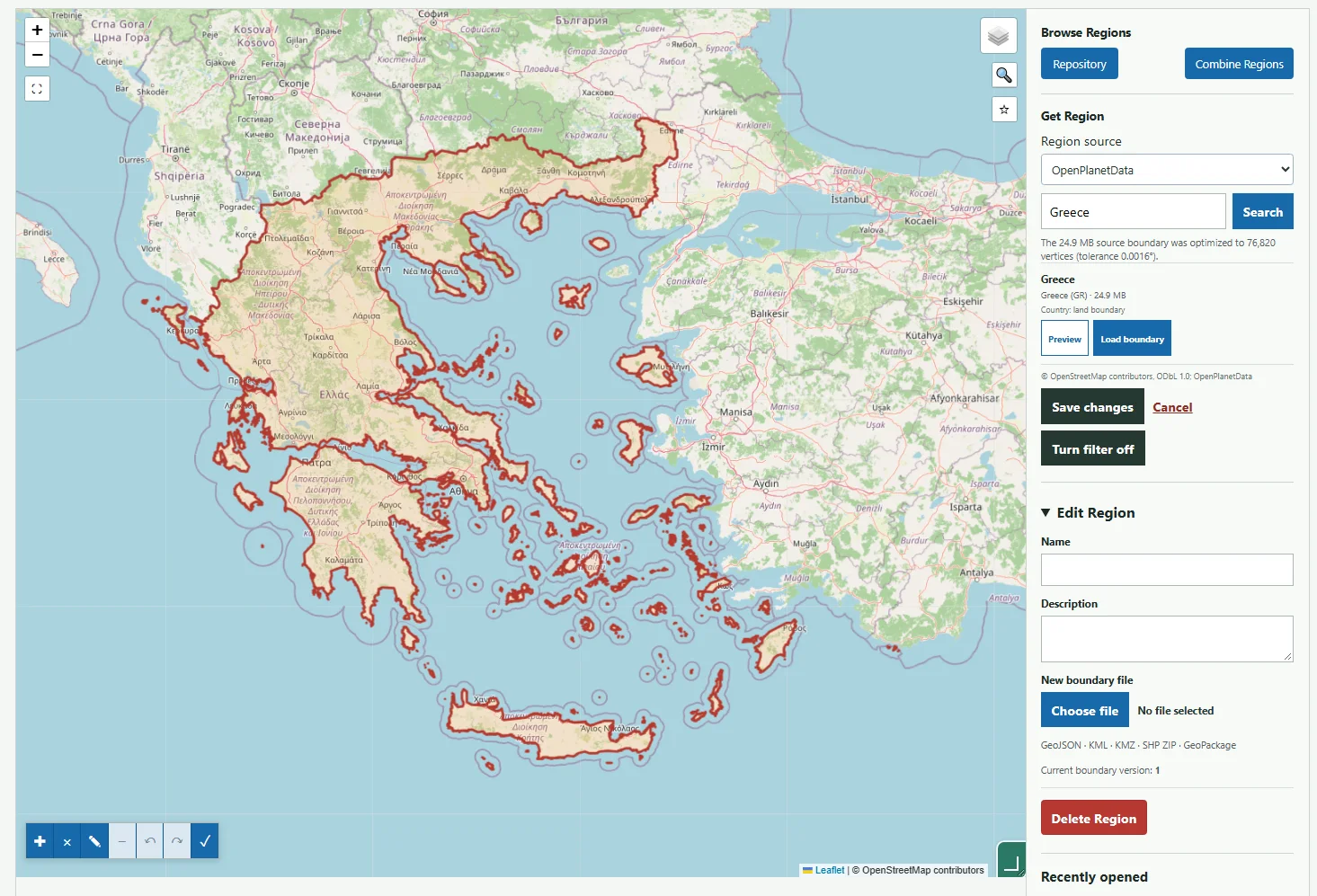
OpenPlanetData: the land outlines of Greece. The boundary follows the mainland coast and individual islands.
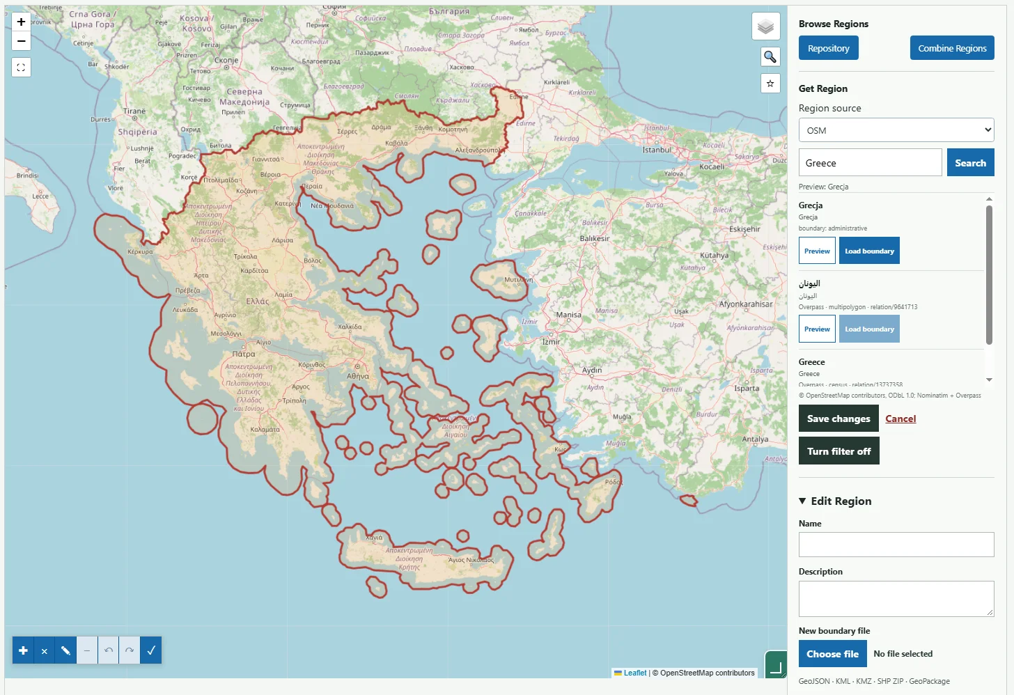
OSM: the administrative boundary of Greece. The outline also includes the sea between the mainland and islands.
OSM or iNaturalist? The Crete example #
The second comparison shows why the source should be selected for the specific Region rather than by one fixed rule. Crete is not available as a separate Region in the current OpenPlanetData catalogue, but it can be found in OSM and iNaturalist:
- OSM maps the coastline of the main island in considerable detail. This
- iNaturalist provides a ready-made place that is useful for observation
boundary is the better choice when the working Region should represent the land area of Crete.
workflows, but its boundary is visibly generalized. It includes a belt of sea and several nearby islands and rocks, so it should not be treated as an exact coastline outline.
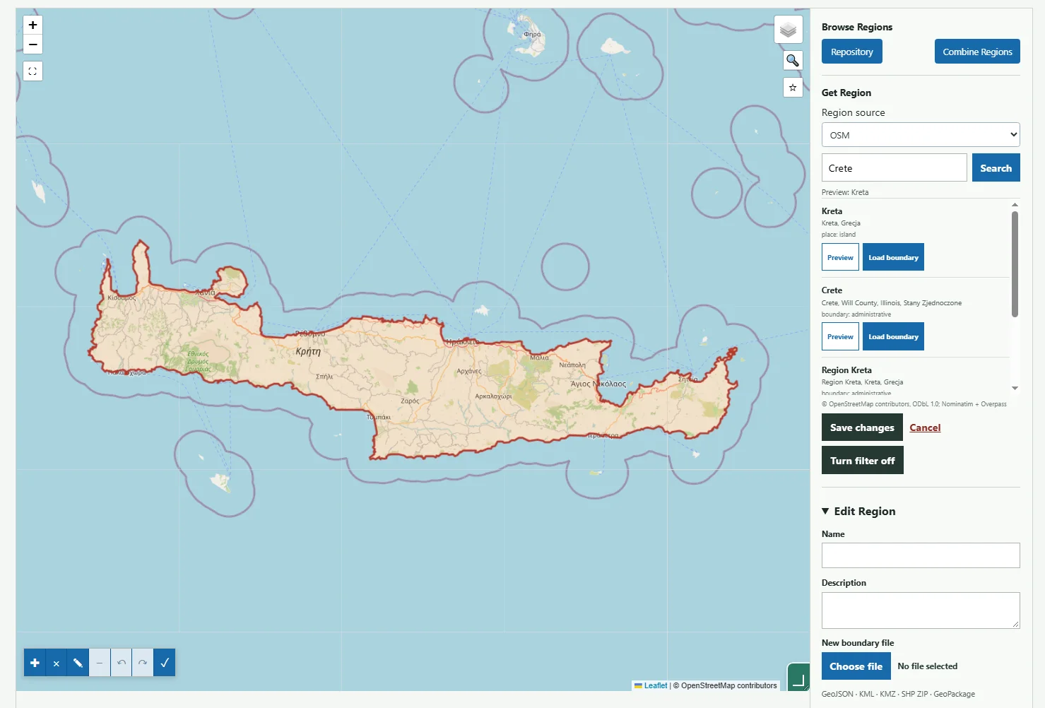
OSM: a detailed land outline of Crete. The boundary follows the actual coastline of the main island closely.
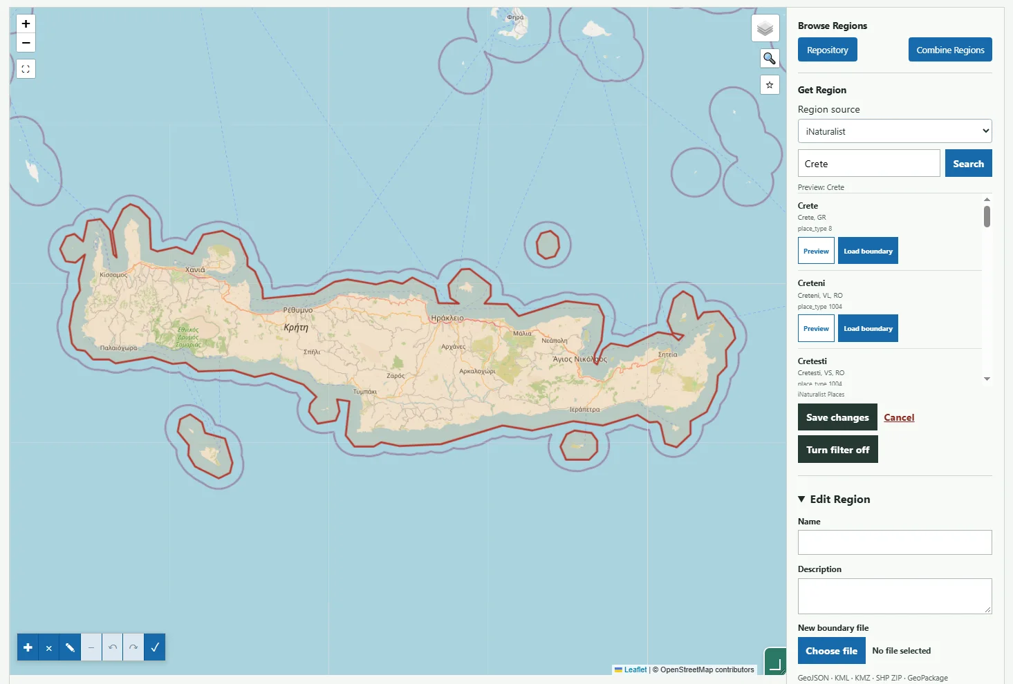
iNaturalist: a ready-made biological place, but with a generalized boundary that also includes sea and nearby islands.
| Need | Recommended source | Reason |
|---|---|---|
| Filter terrestrial observations from a country | OpenPlanetData | The outline is clipped to the coastline and does not include a large sea area |
| Map terrestrial species distributions | OpenPlanetData | The boundary corresponds to the surface where most field observations are made |
| Formal or administrative extent of a country | OSM | The relation may include territorial waters and other administrative boundary elements |
| Park, reserve, administrative region or geographic region | OpenStreetMap | OSM contains many area types that are not part of the land-boundary catalogue |
| Island not available as a separate OpenPlanetData Region | OSM, then compare with iNaturalist | OSM may follow the coastline more accurately, while iNaturalist may provide a broader place used for observations |
OSM is not an incorrect source in this comparison. The sources answer different questions. For typical entomological work with terrestrial records, the OpenPlanetData outline is recommended. Choose OSM when the analysis concerns administrative jurisdiction or a specific OSM object. In both cases, inspect the preview, source date, islands and the boundary near the study area.
OpenPlanetData supplies ready-made land boundaries based on OpenStreetMap boundaries and coastlines. These are not official boundaries or a guarantee of complete accuracy. The boundary may differ from a basemap of another date. Data is provided under ODbL with attribution to OpenStreetMap contributors and OpenPlanetData.
| Capability | Availability |
|---|---|
| Search | Countries and regions in the provider catalog; up to 50 results, refine the query for more |
| Import | GeoJSON up to 50 MB; files up to 15 MB stay unchanged and larger files are streamed and optimized for safe map preview |
| Save | Personal Region independent of a Dataset; source, license, retrieval time and checksum |
| Export | No separate OpenPlanetData exporter; existing Region capabilities apply |
An OpenPlanetData source file may be up to 50 MB. Files up to 15 MB are preserved without additional simplification. Larger files are downloaded as a stream and automatically simplified to no more than 100,000 vertices so they do not overload the server or browser. After preview, ENTOMONE reports the resulting vertex count and tolerance in degrees. Review the outline on the map before saving; for work very close to a boundary, choose a simpler source or prepare a custom GIS file. This is not a search of every OSM object. The catalog and successfully retrieved boundaries are cached for 24 hours. A saved personal Region is a stable snapshot, also saved as GeoJSON on the connected Google Drive, and is not automatically updated from the source.